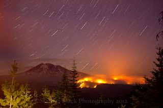
The Cascade Creek Wildfire on Mount Adams has been growing more heavily the last couple days, with estimated burned acreage up to 13,727 acres as of the morning of Sept.23, 2012. You can find details on the inciweb site along with many other major wildfires in the Northwest.
The first map, courtesy of Inciweb, shows the current boundaries. The second map courtesy of Darryl Lloyd of Hood River, is yesterdays boundary map with notations pointing out various features and trails.
These following photos are mine, and I have been selling them in card form at the fire camps, and they are all some of the images in my 2013 Fire Calendar that I am selling at the camp also for $25.


No comments:
Post a Comment